The Shiro Copr - The access road to trans Flores in Ilebura District, East Flores Regency, NTT is flooded by cold lahar. Male Lewotobi Mountain .
The cold lahar flood was triggered by heavy rainfall in the summit and slopes of Mount Lewotobi Laki-laki.
The heavy rain that started on Monday (28/7) brought volcanic materials such as sand, gravel, and rocks that had been buried due to eruption activities.
Abdul Muhari, head of the Center for Disaster Data, Information and Communication of BNPB, mentioned that cold lava floods hit two villages, Nurabelen Village and Dulipali Village.In Nurabelen Village, the cold lahar flood flows through 4 channels: Dusun A Route, which is outside the residential area, Dusun B Route, which is around the houses of the residents, TPI Route, and Waikula RT 9 Dusun B Route.
"The four channels are the river normalization channels," said Abdul Muhari in a press release, Wednesday (30/7/2025).
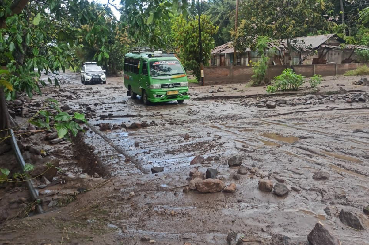
While in Dulipali Village, Cold mudflow Flowing into the village settlements and covering the Trans Flores national road connecting East Flores-Sikka.
Desa Dulipali is also an area included in the Disaster Prone Area (KRB) of the Erupption of Mount Lewotobi Laki-laki.Although it flowed into the village, no casualties were reported. This is because the residents of Dulipali Village had already evacuated since the last eruption of Mount Lewotobi Laki-Laki, which occurred on Monday (7/7).
Although there were no casualties, the traffic on the Flores crossing was disrupted due to mud deposits and pile-up of materials on the road carried by the cold lava flood.
Cold lava flood, the Regional Disaster Mitigation Agency (BPBD) of East Flores Regency immediately sent a team to the location to assess the impact of the cold lava flood. Cleaning of lahar material has also been carried out with the help of heavy equipment.BPBD on the spot also coordinates with TNI, Polri, Nurabelen Village Government and local volunteers to accelerate the cleaning process.
Until now, the volcanic activity level of Mount Lewotobi Laki-laki remains at Level IV or Alert. The last eruption was recorded on Monday (7/7) with a column height reaching 18,000 meters above the peak. This eruption was reported as the highest since 2023.
"Masyarakat and tourists are advised not to carry out activities within a 6 km radius and a 7 km sector from the crater peak," he said.
While facing the danger of cold lava flows, the BNPB urges residents to remain vigilant and avoid river or canal areas originating from Mount Lewotobi Laki-laki, especially during rainy periods.
"Immediately evacuate to a safer place if heavy rain lasts more than one hour," he said. (fat/jpnn)
Comments
Post a Comment